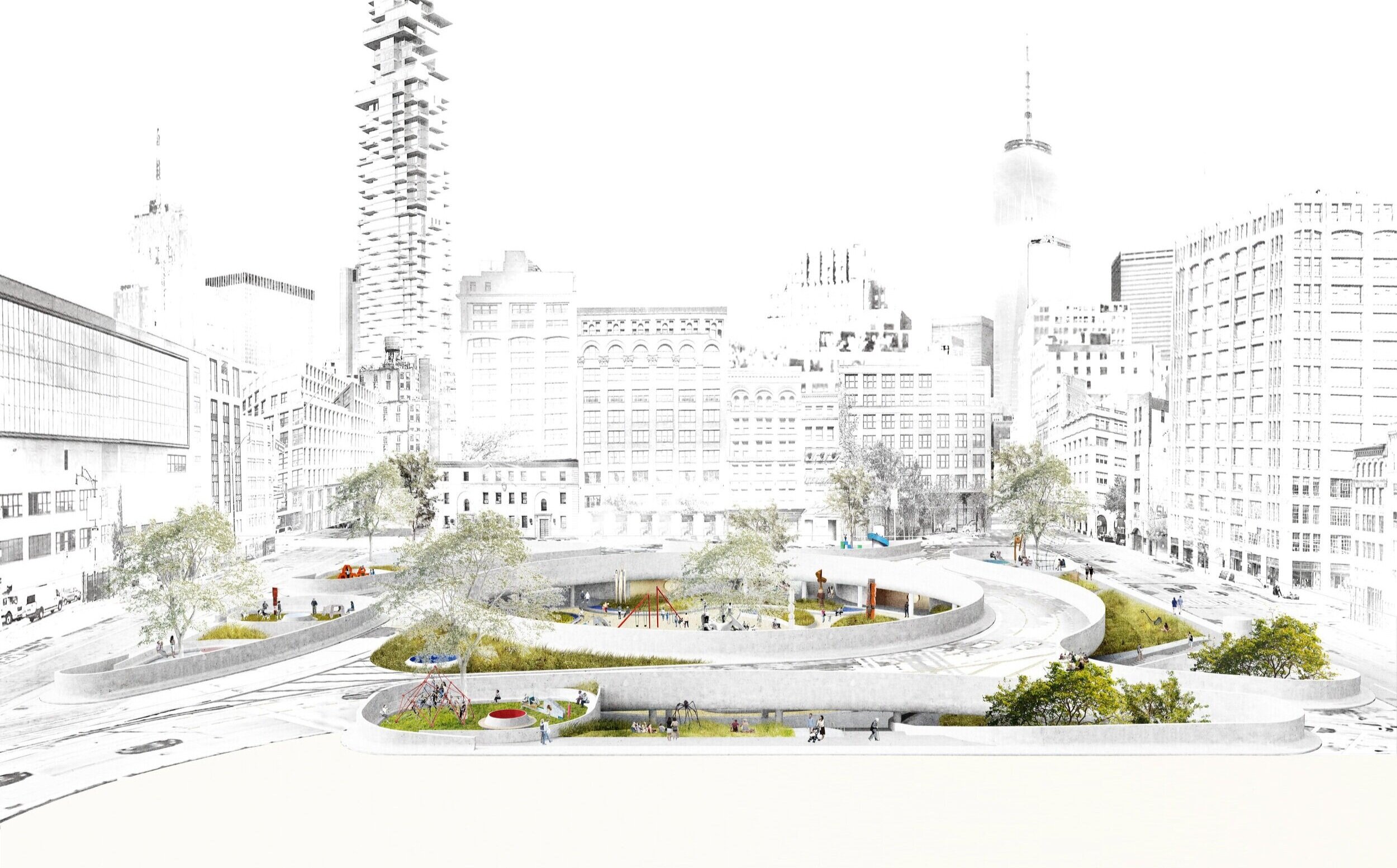
The site of the Holland Tunnel Rotary has a layered ecological, social, and urban history. Rotary Park is a chance to engage with this history in a meaningful way through programming, education, and design.
Manahatta
Until 1524, the Munsee Lenape people solely occupied present-day Manhattan. In 1626, the Dutch West India Company “purchased” Manhattan from the Canarsees for about 60 guilders (1,000 USD) worth of goods.
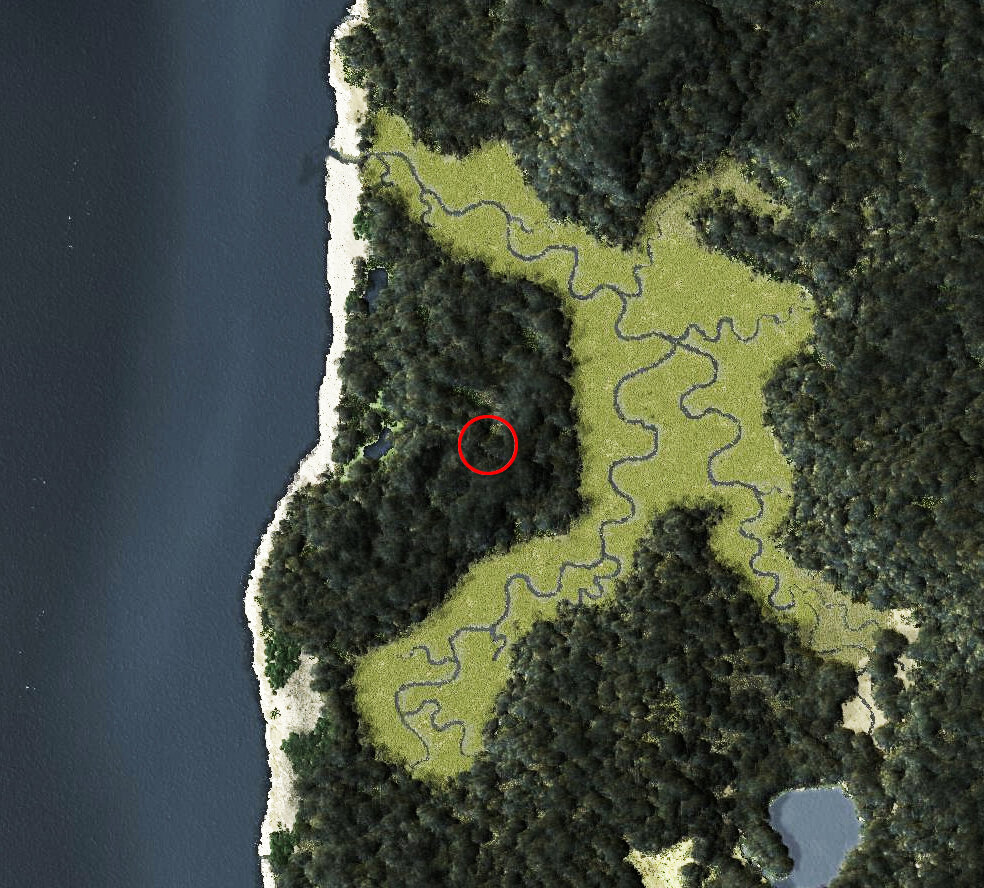
To the right, the site of the Holland Tunnel Rotary is marked in red on the 1609 Welikia map of the island. The site sits on a natural peninsula at the edge of a wetland that would eventually become Canal Street.

Dutch Farmstead
In 1636, a 62-acre farmstead was created which would be cultivated and inhabited by a single family for the next few decades. As the northern frontier of the Dutch colony, this farm was vulnerable during periods of conflict with the Lenape and the Dutch colonists would eventually flee south to Wall Street for protection.
The “Land of the Blacks”
In the 1640s, a new plantation was created at the northern edge of the Dutch colony directly adjacent to the Rotary site, serving as a buffer zone between the existing farmlands and the Lenape. This plantation, which primarily consisted of marshy wetlands, was granted to freed slaves for cultivation.
Known as the Land of the Blacks, or alternatively the Negro Plantations, it is considered by some scholars to be the first community of freed African people in North America.
The Treaty of Westminster
In 1674, the Dutch relinquish Manhattan to the British, who would immediately revoke the property rights of the African homesteaders.
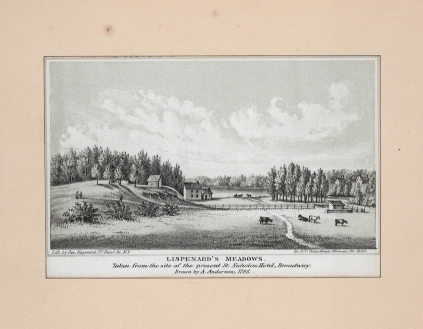
In 1705, a large portion of land known as King’s Farm, which included the present site of the Holland Tunnel Rotary as well as the adjacent plantations, was leased to Trinity Church. As part of Lispenard Meadows, it remained largely undeveloped for the next century.

St. John’s Park
In 1800 Trinity Church developed a new neighborhood, creating an elite square of townhouses modeled after London’s West End and anchored by the new St. John’s Chapel. Eventually named St. John’s Park, it was the city’s first private park development and was open only to residents with a key.
By the 1850’s, the neighborhood had become industrialized with the construction of the Hudson River Railroad, and its wealthy residents begin to move away.
St. John's Park razed to make way for a new train depot.
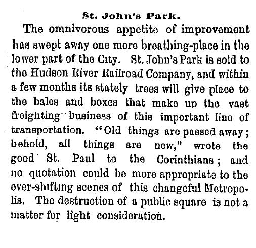
Excerpt from 1867 New York Times coverage of the demolition of St. John's Park.

St. John’s Park Freight Depot
The site was sold to Cornelius Vanderbilt in 1866, who razed the park’s 200 trees to put up a new freight depot.
In the 1920’s, the Hudson River Railroad, which was at street level, was replaced by the elevated High Line and a new terminal building was constructed at 550 Washington Street. In 1927, Vanderbilt’s freight depot was demolished.

Holland Tunnel Rotary
The site was used as a gravel truck yard until 1960, when the Holland Tunnel Rotary was built to improve traffic distribution at the exit of the Holland Tunnel.

Art in the Rotary
In 1980 Richard Serra’s St. John’s Rotary Arc was installed on-site for seven years, and Mark di Suvero’s Joie de Vivre was there from 1998 to 2006.

Present day
Described as a “circular wasteland” in the AIA Guide to New York City, St. John’s Park stands empty and inaccessible.
Rotary Park will make this space available to everyone, for the first time in its history.